TOURISM IN ANTARCTICA: A NEW CRUISE SHIP ACCIDENT HIGHLIGHTS THE DANGERS OF ANTARCTIC TOURISM ON THE MOST PRISTINE CONTINENT OF OUR PLANET

Norwegian cruise ship hits Antarctic ice

Published: Dec. 29, 2007 at 8:35 PM


EDUARDO FREI MONTALVA STATION, Chile, Dec. 29 (UPI) -- A Norwegian cruise ship sustained minor damage overnight Saturday when it lost power and bumped into a glacial iceberg along the Antarctic coast.

The MS Fram (see photo of the ship), carrying 318 passengers, was anchored at Chile's Eduardo Frei Montalva Station at King George Island after the accident, Mercopress reported. No one was injured, the news agency said.

The accident occurred when the ship lost power just after it finished a planned landing at Brown Bluff.

"We hit a glacier. We have damage to a starboard lifeboat and a little bit forward," said Steinar Hansen, the Fram's captain.

A power outage that lasted 40 to 50 minutes sent the vessel adrift against a wall of glacial ice before power was restored.

It's the second Antarctic cruise ship to run into trouble in recent weeks. On Nov. 24, the MS Explorer -- a cruise ship operated by a Toronto company -- hit an iceberg off Antarctica, forcing its 154 passengers and crew into lifeboats in the middle of the night. They waited more than three hours before they were rescued by another cruise ship.
________________________________________________________________

The Fram anchored before midday near Chile's Eduardo Frei base in an ice-free area west of King George Island.

"Everything is fine on board and we still have all the passengers on board," Hansen said. He added that the ship was "waiting for orders" on whether to continue its voyage.

Robert O'Connor, a 26-year-old American from South Bend, Ind., said he was in his cabin late Friday when the ship's crew told the passengers to head above deck.

"The electricity on the ship went out and we started drifting backward," he told the AP. "I actually saw the wall of ice coming up the starboard side. It came up fairly quickly, the ship drifted into it."

He reported a jarring impact that bent the railing and buckled the lifeboat. The captain and crew checked the ship and calmed nervous passengers, and after that "there were free drinks on the house," he said.
____________________________________________________________

The Antarctic and Southern Ocean Coalition

ASOC Secretariat
1630 Connecticut Ave NW Washington, DC 20009 USA
Tel: 1-202-234-2480 Fax: 1-202-387-4823 www.asoc.org
November 26, 2007

ASOC Statement on the Sinking of the Tourism Cruise Vessel MV Explorer in Antarctica


ASOC regrets the sinking of the tourism cruise vessel MV Explorer off King George Island,1 South Shetland Islands, 24 November 2007, and expresses its relief that the safety of all aboard has been protected by the action of the ship’s crew and the international rescue effort that followed evacuation of the ship. This accident happened to a well-tested, ice-strengthened vessel run by experienced crew that operates fully under current industry guidelines in a location that is, for Antarctic standards, well known. Notwithstanding this, providing assistance resulted in a major undertaking involving a number of other ships and disjunction to the activities of several National Antarctic Programs. The environmental impact of the sinking of the vessel is a cause of concern. The ship is reported to carry more than 180,000 liters of marine diesel. While most of the fuel may still be contained in the vessel it will eventually be discharged into the marine environment. The fact that such an accident could occur with such a vessel, in such a well-known part of Antarctica, demonstrates the continuing risk of all tourism operations in Antarctica. As with other incidents involving Antarctic tourism cruise vessels in the past twelve months, this accident could be described as a “best case scenario” – the weather conditions were relatively good, nobody was hurt during the collision or evacuation, and help was at hand. The accident highlights the risks of conducting Antarctic tourism in larger or less suitable vessels, by less capable operators, or in parts of Antarctica that are less well-known or more remote, where there would be less help at hand. This incident involving a capable vessel with just over 150 people aboard throws into stark relief the risks posed by the enormous vessels which have now begun to operate in the Antarctic, some of which carry five or more times that number of people. Not only do these vessels carry more fuel, but also the largest ones tend to carry heavy fuel oil, which poses an even greater risk to the marine environment.

Antarctic tourism has been growing, expanding and diversifying at a rapid pace for well over a decade, yet the Antarctic Treaty System lacks of a comprehensive policy for tourism in Antarctica. ASOC believes that there is an urgent need for Antarctic Treaty Consultative Parties to establish sensible operating rules before a catastrophe occurs. Steps to be considered include banning ships exceeding a certain size and carrying more than a certain number of people or a certain amount of fuel on board, establishing ice-strengthening standards for vessels which go into Antarctic waters, and reviewing how existing regulations are complied with, particularly with regard to Environmental Impact Assessment (EIA) to assess whether the actual or potential impacts of tourism are sufficiently taken into consideration, including not only the impact of routine operations but also impacts of potential contingencies. Annex VI to the Antarctic environmental Protocol on Environmental Liability Arising from Environmental Emergencies was signed in 2005 after more than a decade of negotiation. To date, the Parties that have ratified Annex VI are The Netherlands, New Zealand, and Sweden. ASOC notes the duty of Antarctic Treaty Consultative Parties to ensure the entry into force of Annex VI on Liability as a matter of urgency. In line with government statements about protecting the polar environment, ASOC contends that Annex VI should enter into force before the end of the International Polar Year 2007-08.


For further information please contact:

Jim Barnes
Email: jimbo0628@mac.com

Ricardo Roura
Email: ricardo.roura@worldonline.nl (English, Spanish)


Note to editors regarding recent incidents involving Antarctic tourism vessels


• Grounding of the Nord Kapp at Deception Island, 31 January 2007. The accident resulted in the spillage of marine diesel into the marine environment and resulting environmental damage. There were no victims.

• Grounding of the Luybov Orlova at Deception Island, 15 November 2006. It is believed that the rescue call was made 15 hours after the vessel grounded, at which time no MAYDAY call was raised. There was potential for the situation to have worsened. The Luybov Orlova was towed off the sandbank, taking 3 hours to complete.


SULLA VIA DEL POLO SUD


Sulla via del ritorno verso la stazione norvegese Troll, la
traversa norvegese/americana che sta percorrendo il plateau polare in direzione del Polo Sud geografico
(Norwegian-U.S. Scientific Traverse of East Antarctica) passerà nella zona dei laghi subglaciali Recovery, scoperti recentemente da Michael Studinger e colleghi, del Lamont-Doherty Earth Observatory, Columbia University. I laghi, in numero di 4, sono sepolti sotto più di 3.000 metri di ghiaccio nell'area del ghiacciaio Recovery. Il tragitto della traversa è indicato in giallo nello schema e il triangolo nero corrisponde ai Laghi Recovery. La superficie totale dei quattro nuovi laghi subglaciali corrisponde alla superficie del lago Vostok, il più grande e il più studiato degli oltre 150 bacini subglaciali dell'Antartide (superficie del lago Vostok: 15.690 km2). L'occasione di passare nella zona dei laghi Recovery permetterà ai membri della traversa norvegese/americana di compiere rilevamenti sismici, radar e GPS al di sopra dei laghi.Leggere il blog della traversa anche su http://www.ipy.org.

In questi giorni sono passati al di sopra di formazioni simili a megadune, mentre la settimana scorsa hanno visitato una base scientifica americana abbandonata 50 anni orsono, mezza sepolta nella neve. Presto dovrebbero raggiungere il
Polo di Inaccessibilità, il punto del continente antartico più lontano da qualsiasi linea costiera. Si trova 463 km dal Polo Sud geografico a 3718 metri sul livello del mare. Il Polo Sud dell'inaccessibilità fu raggiunto per la prima volta da una spedizione sovietica il 14 dicembre 1958 organizzata durante i lavori di ricerca dell'Anno geofisico internazionale.

Schema: M. Studinger-LDEO, con dati di M. Siegert e NSIDC

Tutto è bene quel che finisce bene

Dopo aver visto le fotografie del Basler DC-3 incidentato, c'è da pensare che se non fosse stato per la bravura e la grande esperienza dei piloti di Kenn Borek Air, la faccenda avrebbe potuto avere conseguenze più serie. A giudicare dalle foto scattate da un passeggero, sebbene l'aeromobile sia parecchio danneggiato, l'atteggiamento delle dieci persone coinvolte sembra tranquillo. Secondo le testimonianze (oramai pubblicate ovunque su internet), dopo l'incidente sono stati aperti i borsoni di sopravvivenza e montate le tende, in attesa dei soccorsi giunti 18 ore dopo l'accaduto. Due altri Twin Otter della Kenn Borek sono arrivati a recuperare i 6 passeggeri (ricercatori del progetto POLENET) e i 4 membri di equipaggio, per condurli a McMurdo. La Kenn Borek Air è una compagnia canadese con sede a Calgary (Alberta): ha una lunga e notevole esperienza di voli nelle regioni polari, nell'Artico e in Antartide, oltre ad avere dei Twin Otter-idrovolanti anche alle Maldive. In Antartide, i Twin Otter bianchi e rossi della Kenn Borek Air sono noleggiati dal Programma Polare Americano, dal Programma Nazionale di Ricerche in Antartide Italiano e dall'Istituto polare francese Paul-Emile Victor. Il "nostro" Twin Otter - quello attualmente operante fra la stazione Italiana Mario Zucchelli a Baia Terra Nova, la base italo-francese Concordia, Dumont d'Urville e McMurdo porta il nome in codice di Kilo Bravo Charlie. E' lo "shuttle" che fa la spola fra basi scientifiche "vicine di casa" - in un continente grande una volta e mezzo l'Europa. Trasporta passeggeri, viveri, materiale, la posta. E' indispensabile allo svolgimento di una spedizione scientifica e per la vita delle stazioni. Tutti conoscono la sua silhouette familiare, le sue eliche a striscie bianche e nere, la bandierina canadese sulla coda, il rumore che fa al decollo, all'atterraggio e quando fa taxi sulla pista di neve. Fa parte della nostra vita quotidiana in Antartide.

L.S.

ABOUT THE BASLER DC-3


Press Release 07-189
NATIONAL SCIENCE FOUNDATION

December 21, 2007


A National Science Foundation (NSF)-chartered aircraft operating in Antarctica crashed shortly after take-off earlier this week while providing support to a group of researchers at a remote location on the southernmost continent. None of the 10 people aboard was injured, but the DC-3 Basler was severely damaged.

The aircraft, which is owned by Kenn Borek Air Ltd., a Canadian aviation firm, experienced difficulties in taking off from a field site near Mt. Patterson in West Antarctica on the morning of Dec. 20, local time (U.S. stations in Antarctica keep New Zealand time), roughly 550 miles from McMurdo Station, NSF's logistical hub in Antarctica.

The six passengers aboard the plane were part of the NSF-funded portion of the international Polar Earth Observatory Network (POLENET) project, which is deploying GPS units and seismic sensors across Antarctica to make observations that are vital to understanding how the massive ice sheets are changing. In turn, these measurements are critical to understanding how ice sheets affect sea level worldwide, and thereby global climate in general.

The POLENET team and four aircraft crewmembers were flown back to McMurdo Station.

As a matter of routine, the incident is under investigation by the Department of the Interior's Aircraft Management Division (AMD). NSF has a memorandum of agreement with the Interior Department to conduct such investigations. As the managing federal agency for the U.S. Antarctic Program, NSF coordinates and supports all U.S. scientific research on the southernmost continent and in surrounding waters.

AMD has contacted the National Transportation Safety Board (NTSB) about the incident. The NTSB will coordinate as necessary with the Transportation Safety Board of Canada.

Because the cause of the accident is under investigation, NSF will have no further comment, pending the conclusion of that investigation.

PHOTO CREDIT: Dominick Dirksen/National Science Foundation (January 2007)

Media Contacts
Peter West, NSF (703) 292-7761 pwest@nsf.gov
____________________________________________________________________

The National Science Foundation (NSF) just awarded the collaboration, called POLENET, $4.5 million to plant global positioning system (GPS) trackers and seismic sensors on the bedrock that cradles the West Antarctic Ice Sheet (WAIS). Lead institution Ohio State University will receive more than $2.2 million, and the rest will be divided among partners in the United States as part of an International Polar Year project.

As scientists have tried to understand how climate change is affecting the WAIS, they have long wished they could gather information from the entire region, explained POLENET leader Terry Wilson. But Antarctica contains the coldest and windiest sites on the planet -- locations inhospitable to scientific instruments and the scientists who would deploy them.

In a presentation Tuesday, December 11, 2007 at the American Geophysical Union meeting in San Francisco , she described how her team will overcome the harsh environment. They'll fly ski-equipped aircraft to remote locations, and plant rugged instruments that will send signals back to the United States via satellite.

“We'll be able to do systems-scale science in Antarctica . That wasn't possible before,” said Wilson, associate professor of earth sciences at Ohio State. “This instrumentation is designed to run and record data year-round, through the dark polar night. Previous instrument deployments have largely operated only for a few months, or less, each year. This allows us to do new science.”

In a related project over the summer of 2007, POLENET scientists installed two dozen GPS trackers in Greenland. By the end of February 2008, the scientists plan to have 17 new trackers installed around the WAIS, along with about 11 new seismic sensors. The first expeditions began arriving in Antarctica early in December, 2007. The network will be complete in 2010 and will record data into 2012. Selected sites may remain as a permanent Antarctic observational network.

Scientists around the world will be able to access POLENET data online, and schools will be able to access educational resources.

Source: OHIO State University, The Washington Post

LES PRESENTOIRS CONCUS POUR "ANTARCTIQUE"

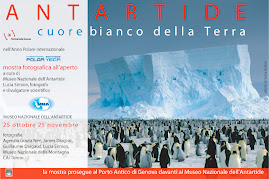
Le service Commercial des Editions Belin a conçu des présentoirs pour les beaux livres comme "Antarctique, Coeur blanc de la Terre" et "Dragons". Ces présentoirs sont élégants et très pratiques pour mettre en valeur les livres et permettre aux clients de la librairie de les feuilleter tranquillement, à la juste hauteur. Sur la partie verticale du présentoir sont indiqués le prix de l'ouvrage et le nombre de pages. Cinq carte de voeux sont offertes gratuitement avec le livre "Antarctique, Coeur blanc de la Terre".

IPY POLAR BOOKS COLLECTION


The Global Outlook for Ice and Snow, by Joan Eamer (June 2007), Vanishing World by Mireille de la Lez and Fredrik Granath, (October 2007) and Antarctique, Coeur blanc de la Terre - by Lucia Simion (photos from different photographers) have been selected by the International Polar Year Office to be in an "IPY POLAR BOOKS" collection.


LAC VOSTOK: LES EAUX DU LAC, ENFOUI SOUS 4.000 METRES DE GLACE DEPUIS DES MILLIONS D'ANNEES VONT BIENTOT ETRE ATTEINTES. QUEL SERA LE FUTUR?


SAINT-PETERSBOURG,
20 décembre 2007- RIA Novosti.


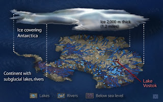
Des scientifiques russes comptent terminer en 2008-2009 les forages qui leur permettront d'atteindre le lac Vostok, dont les eaux enfouies sous 4 kilomètres de glace dans l'Antarctique constituent un écosystème unique, a annoncé Valeri Loukine, le chef de l'expédition antarctique russe.

Cet espace aquatique grand comme le lac Ontario est isolé de la surface depuis maintenant environ un million d'années, ce qui en fait une structure fossile tout à fait inédite.

L'absence totale de lumière, la forte pression et la composition particulière de l'eau (gaz et composition chimique), ajoutés à son isolement complet, laissent penser aux chercheurs qu'il y existe des formes de vie absolument distinctes de celles connues de la science contemporaine.

"Au cours de cette saison, nous comptons descendre de 50 mètres supplémentaires. Nous devrions atteindre les eaux du lac au cours de la période 2008-2009", a déclaré M. Loukine.

Selon lui, le navire expérimental Akademik Fedorov acheminera prochainement un nouveau câble dans l'Antarctique.

Le directeur de la chaire des technologies de forage de l'Université de Saint-Pétersbourg Nikolaï Vassiliev a expliqué que ce câble de rechange était nécessaire en raison de l'extrême état de délabrement du précédent.

Selon M. Vassiliev, après avoir atteint 3.000 mètres sous le niveau de la mer, le puits a permis d'observer des changements substantiels dans la structure de la glace, qui contient notamment des cristaux en nombre plus important. Des protéobactéries et des actinomycètes probablement âgés d'environ 500.000 ans avaient également été trouvés auparavant dans les prélèvements de glace.

Le forage, qui a débuté dans les années 1970 alors qu'on ignorait encore tout de l'existence de lac, était réalisé dans le cadre d'études paléo-climatiques. Le puits atteint actuellement 3.663 mètres.

L'étude du lac joue un rôle capital dans la compréhension et l'étude des changements climatiques des prochains millénaires et de la formation planète.

L'opération de forage permettra en outre de jeter les bases de la future exploration d'Europe, la lune glacée de Jupiter, qui recèle peut-être un océan liquide sous une épaisseur de glace similaire et pourrait contenir des formes de vie extraterrestre.

Le premier échantillon d'eau du lac devrait être prélevé en 2008-2009.

ILLUSTRATION: ZINA DERETZSKY/NATIONAL SCIENCE FOUNDATION

23 DECEMBRE 2007: GRAND SOLEIL A' SCOTT BASE


23 Décembre 2007, à 2 h de l'aprèm: la webcam de Scott Base (NZ) a pris cette image. Deux jours avant Noël, journée radieuse, grand soleil et plus beaucoup de neige sur le terrain autour de la base. Sur le fond, au delà de la plateforme de Ross: White Island (sur la gauche) et Black Island (à droite).
Les images sont mises à jour toutes les 15 minutes.
Pour "ouvrir votre fenêtre sur l'Antarctique" allez sur le site de
Antarctica New Zealand (le Programme Polaire Néozelandais), puis cliquez sur "Webcam". Il y en a deux: une à Scott base et une à Arrival Heights.

Photo: webcam de Scott Base, Antarctica New Zealand.

ARCHEOLOGIE ANTARCTIQUE


Cela fait presque un mois qu'une équipe d'archeologues "polaires" néozelandais est en train de retaper les refuges historiques de Scott et de Shackleton sur l'Ile de Ross, à Cape Evans et à Cape Royds respectivement. Il s'agit d'un projet en collaboration avec Antarctic Heritage Trust et Antarctica New Zealand.
Je suis passée les voir à Cape Evans, le 18 Novembre, de retour de Cape Royds où j'avais visité le refuge de Shackleton en compagnie d'un groupe de Kiwi. Ici à droite (dans une image qui a été réalisée par un membre de l'équipe) l'archéologue Neville Ritchie en train de travailler sur l'annexe de Birdie Bowers à Cape Evans. J'en profite pour lui dire "bonjour" depuis Paris.

Voir plus de news sur ce site (faire copié-collé):

http://piclib.nhm.ac.uk/antarctica/?cat=6

FILM: 430 JOURS DANS LE DERNIERS DES CONTINENTS

Le Dernier Continent, c'est l'Antarctique - biensûr. Le dernier des continents à avoir été découvert, il y a moins de 200 ans (environ 1820).
Le cinéaste-biologiste Canadien Jean Lemire lui dédie un film - qui est le récit de plus d'un an passé à bord du voilier Sedna IV, en Péninsule antarctique, pour observer et filmer les effets du changement climatique. Le film est sorti au Québec le 21 décembre. Nous attendons avc impatience qu'il arrive dans les cinémas en France.


Photos: en haut, le Sedna IV dans le royaume des glaces; en bas, l'équipe de tournage et des membres de l'équipage observent un gros phoque léopard qui vient les voir.

Crédits:
site officiel du film sur http://www.lederniercontinentlefilm.com/


PENGUIN SKETCHES BY SCOTT AND SHACKLETON

December 21st, 2007

Penguin sketches made by Captain Scott and Ernest Shackleton have been found in a basement at Cambridge University.

The legendary explorers drew the pictures on blackboards, probably for public lectures, in 1904 and 1909.

Source and photo: BBC News


VOSTOK STATION CELEBRATES ITS 50th ANNIVERSARY

ST.PETERSBURG, December 16 (Itar-Tass) -- The southernmost stronghold of the Russian polar science – the polar station Vostok (East) in the Antarctic celebrates its 50th anniversary on the ice top of the sixth continent. The directorate of the Russian meteorological service, colleagues from the Artic and Antarctic Research Institute and relatives of polar explorers congratulated the staff of the polar station on their holiday.

Among five permanently operating Russian Antarctic stations the polar station Vostok is the only station situated on the plateau glacier in the East Antarctic at an altitude of 3,488 meters above the sea level, the deputy director of the Artic and Antarctic Research Institute and the chief of the Russian Antarctic Expedition, Valery Lukin told Itar-Tass.

He noted that “the participants of the sledding voyage during the second Comprehensive Antarctic Expedition headed by a legendary Polar explorer and the Hero of the Socialist Labor, Alexei Fyodorvich Treshnikov, set up the polar station Vostok.” “The polar station Vostok was deployed under the national program of the International Geophysical Year (1957-1958) for the round-the-year meteorological and geophysical monitoring on the southern geomagnetic pole of the Earth,” Lukin said. Glaciologist Vyacheslav Averyanov was the first chief of the polar station Vostok, he added.

Polar explorers call the polar station “the harshest place on the sixth continent.” “Those who did not visit the polar station Vostok did not see the Antarctica,” they said jokingly.

Experienced polar explorers said, “No living creature, except for the man, can survive in intercontinental districts of the Antarctica.” The polar station Vostok is the cold pole of the Earth. “The average annual air temperature in this Antarctic district makes 55 degrees below zero. 89.2 degrees below zero that is the lowest temperature on the Earth was registered in July 1983. The round-the-clock polar night lasts about four months there. The normal atmospheric pressure amounts to 460 mb as that on the Elbrus top. The humidity is lower than in the Sahara Desert,” Lukin said.

Polar explorers discovered the subterranean lake and called it Vostok near the Russian polar station under the four-kilometer ice crust in the second half of the twentieth century. “The unique water body is considered one of the greatest geographical discoveries in the twentieth century. The lake remained isolated from the air for several million years,” Lukin pointed out. At present, Russian polar explorers are going to take environment-friendly water samples in the lake through the unique well.

For half a century the Vostok polar explorers “have conducted unique scientific experiments that made Russia one of the leading nations in the international Antarctic community,” the chief of the Russian Antarctic Expedition indicated. Lukin named among the priority experiments “the comprehensive monitoring of geomagnetic and ionospheric parameters that characterize the energy inflow of the solar wind on our planet.” He considers a not less significant experiment for the world science “the unique drilling of the ice crust in the East Antarctica in order to create palaeoclimatic reconstructions of the Earth.”

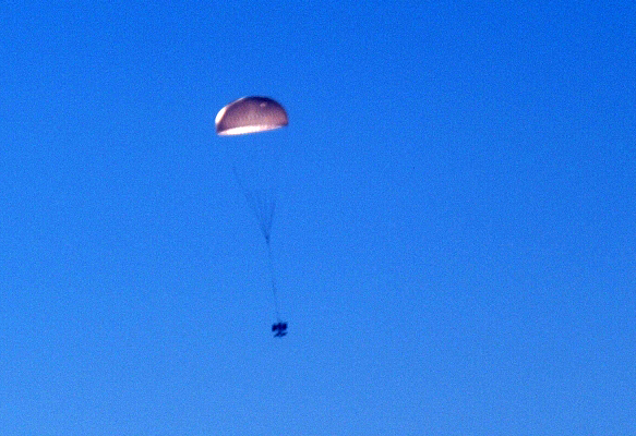
“Earlier crawlers went from the polar station Mirny and planes made inland flights to deliver necessary supplies for the polar station Vostok and substitute its staff,” Lukin said. An airplane BT-67 with the ski landing gear has been delivering the supplies for the polar station Vostok from the coastal polar station Progress already for several years. Since 2005 an airplane Il-76TD has been making flights from the ice airfield at the polar station Novolazarevskaya to parachute the cargoes for the polar station Vostok, Lukin noted.

PHOTO CREDIT: Todd Sowers LDEO, Columbia University, Palisades, New York/NOAA

LE JAPON RENONCE A' CHASSER 50 BALEINES A' BOSSE (MAIS VA MASSACRER 1.000 PETITS RORQUALS)

Sous la pression internationale, Tokyo renonce à tuer les baleines à bosse - AFP


TOKYO (AFP) — Le Japon a annoncé vendredi qu'il renonçait à reprendre la chasse aux baleines à bosse, abandonnée depuis quatre décennies, à la suite d'une campagne de protestations internationales dirigée par l'Australie.

Cette décision, exceptionnelle de la part du Japon qui n'avait jusqu'ici jamais fait de concession en matière de chasse à la baleine, constitue une victoire pour le nouveau gouvernement de gauche australien du Premier ministre Kevin Rudd.

"Le Japon ne va pas chasser les baleines à bosse", a déclaré aux journalistes le porte-parole du gouvernement Nobutaka Machimura, en rappelant que l'Australie avait "exprimé son vif mécontentement auprès du Japon à ce sujet".

"En échange, j'espère que cela débouchera sur de meilleures relations avec l'Australie", a-t-il dit.

Pour la première fois depuis les années soixante, le Japon avait annoncé le mois dernier qu'il allait tuer 50 spécimens de baleines à bosse, une espèce considérée comme menacée par les défenseurs de la nature.

Toutefois, la campagne baleinière lancée le mois dernier dans l'Antarctique va se poursuivre avec l'objectif de tuer un millier de baleines, pour la plupart de l'espèce minke, plus petites.

En Australie, l'organisation Greenpeace s'est engagée à maintenir les pressions sur le Japon, en rappelant que la flotte de l'Antarctique a toujours l'intention de tuer une cinquantaine de rorquals, le deuxième plus grand animal sur terre après la baleine bleue, que les défenseurs de l'environnement considèrent comme une espèce menacée.

"Le Japon doit rappeler sa flotte immédiatement, stopper la chasse et renoncer à tout projet de construction d'un nouveau bateau-usine baleinier", a déclaré le représentant de Greenpeace pour l'Australie et le Pacifique, Steve Shallhorn.

Le gouvernement australien a dépêché un navire de guerre désarmé et un avion de reconnaissance pour surveiller la flotte baleinière, qui sera également suivie par deux navires des associations écologistes Greenpeace et Sea Shepherd.

Junichi Sato, qui dirige la campagne contre la chasse à la baleine pour Greenpeace Japon, a estimé que "cela prouve que la pression internationale peut réussir".

Le porte-parole du gouvernement a relevé que le Japon et l'Australie avaient des différences culturelles à propos des baleines, mais que Tokyo souhaitait préserver les relations avec le nouveau gouvernement en Australie.

"Les Australiens trouvent que les baleines sont affectueuses, ce que j'ai du mal à comprendre. Mais apparemment, ils donnent des noms à chaque baleine et le public éprouve un véritable sentiment à leur égard", a commenté M. Machimura.

Il a toutefois démenti que le Japon ait cédé à la pression de l'Australie, affirmant que la décision avait été prise à la suite de discussions avec le chef de la Commission baleinière internationale.

Le Japon contourne chaque année le moratoire international en vigueur depuis 1986 en pêchant un millier de baleines à des fins soi-disant "scientifiques".

Les baleines à bosse, protégées depuis un moratoire décrété en 1966 après des années de chasse extensive, sont réputées pour leurs chants et leurs sauts acrobatiques.

Leur migration le long des côtes australiennes à la saison de la reproduction est devenue une attraction suivie chaque année par 1,5 million de touristes.


BUONE NOTIZIE PER LE MEGATTERE! Il Giappone rinuncia a massacrare le 50 megattere di cui aveva annunciato la cattura


A seguito delle pressioni e delle proteste esercitate dall'AUSTRALIA, la flotta di baleniere giapponesi - che si trova nell'Oceano Australe per massacrare 1.000
balenottere minori e 50 megattere, ha RINUNCIATO a catturare le 50 megattere. Tutte le balene sono specie carismatiche, ma le megattere sono fra le più fantastiche di tutte - fra le più conosciute, fra le più amate. La flotta di cacciatori di balene giapponesi aveva annunciato l'intenzione di catturarne 50 nel corso della stagione 2007-2008, ufficialmente "per ragioni scientifiche", ma in pratica per venderne la carne. Per fortuna, la reazione dell'Australia ha avuto ragione delle mire alimentari dei balenieri giapponesi. Le megattere possono stare tranquille! Ma per MILLE balenottere comuni (Minke whales) sarà il massacro.
Ancora una volta, il sangue tingerà di rosso il SANTUARIO dell'Oceano Australe. Per servire qualche bistecca di carne di balena sui piatti di ricchi personaggi da qualche parte sulla Terra.

Photograph by: Steven Profaizer
National Science Foundation/USAP ANTARCTIC PHOTO LIBRARY


A minke whale surfaces inside the shipping channel through the sea ice near McMurdo Station. Seals, penguins and orcas are also often seen in and around the channel. Date Taken: January 28, 2007

FIRST LANDING AT WILKINS RUNWAY

FROM THE AUSTRALIAN ANTARCTIC DIVISION WEBSITE:


11 December 2007: Australia's new air service to Antarctica is on track after completing its first landing on the new glacial runway this week, view a quicktime video of the landing.

The Airbus A319 landed on the purpose-built Wilkins Runway, around 70kms from Casey station, late on Sunday night and returned to Hobart early on Monday, December 10.

Director of the Australian Antarctic Division, Dr Tony Press, said that it was a very exciting time in Australia's Antarctic history.

"It is a most ambitious undertaking which, for the first time, connects Australia and Antarctica with a permanent air link. It really is a tremendous achievement and marks a significant milestone for Australia's Antarctic Program.

"Operational crews reported that the aircraft handled the conditions well and had nothing but praise for Wilkins Runway. It has been a wonderful reward, too, for the ground support personnel who have worked so hard in sometimes appalling conditions."

The flight to Wilkins carried only operations personnel and was one of a series of successful 'proving' flights before final approval from authorities to allow passengers on board.

Dr Press said that passenger safety was paramount to a successful air link.

"Everything is on schedule as the air link nears final approvals."

Regular operational flights to Antarctica will begin once regulatory approvals are completed over the next week or so.

Media contact: Patti Lucas 0439 639 227

PHOTO by Tom Delfatti: Left, Charlton Clark, Manager - Antarctic Airlink Project and (right) Dr Jeremy Smith, Casey Station Leader with the A319 at Wilkins Runway.
____________________________________________________________________________________

A passenger jet has made a historic landing on a new blue ice runway in Australia's Antarctic territory and regular flights are expected to start within a week, officials said Wednesday.

But trips on the Airbus A319 to the Wilkins Runway will be for scientists and research staff only, with no plans to open the airlink to tourists, project manager Charlton Clark told AFP.

The runway is four kilometres (2.5 miles) long, 700 metres thick and moves about 12 metres southwest a year because of glacial drift.

In the first trial landing on Monday, the plane pulled up within 1,000 metres despite the lack of friction to grab the wheels on the ice.

Clark said work had begun on the 10 million dollar (8.7 million US) runway 70 kilometres from Australia's Casey research station in 2005, with crews living in shipping containers.

"Just living in that environment, with conditions of minus 35 degrees and up to a hundred knots of wind, let alone doing the work, was an amazing undertaking," he said.

Using laser levelling technology, they graded and shaved the ice flat and must keep grooming it to keep it snow free.

The runway was named for the adventurer and aviator Sir Hubert Wilkins, who made the first flight in Antarctica 79 years ago.

Scientists and specialists working at Australia's Antarctic field stations, who previously had to spend weeks voyaging to and from the ice by sea, are expected to start flying within a week, he said.

Other nations with Antarctic research stations have been flying to the icy continent for years from countries such as New Zealand and South Africa, but using military aircraft.

The Australian Antarctic Division says its introduction of a modern jet aircraft, which can complete a return journey without refuelling, marks the start of a new era.

FROM: AFP

THE MOST ACCURATE AND TRUE SATELLITE IMAGE OF ANTARCTICA


PRESS RELEASE ON LIMA (BAS)

Issue date:
27 Nov 2007
Number:
20/2007

A team of researchers from NASA, the U.S. Geological Survey (USGS), the National Science Foundation (NSF) and British Antarctic Survey (BAS) unveiled today (27 Nov 07) the most geographically accurate, true-color satellite photograph ever made of Antarctica.

More than a thousand scenes captured during seven years of satellite observations have created the visually stunning Landsat Image Mosaic of Antarctica (LIMA). The virtually cloudless satellite view of Antarctica's frozen landscape provides much greater detail for the entire continent than has been available before. For the first time researchers and the public can explore Antarctica for themselves in a completely new way.

"This mosaic of images opens up a window to the Antarctic that we just haven’t had before. It will open new doors of opportunity for scientific research as well as enable the public to become much more familiar with Antarctica and how scientists use imagery in their research," said Robert Bindschadler, chief scientist of the Hydrospheric and Biospheric Sciences Laboratory at NASA's Goddard Space Flight Center in Greenbelt, Md. "This innovation, compared to what we had available most recently, is like watching the most spectacular high-definition TV in living colour versus watching the picture on a small black-and-white television."

Advances in satellite technology since the 1970's have revolutionized scientific study of the Earth's greatest natural laboratory. For example, movement of glaciers, previously measured by ground-based measurements or aerial photography, is now much better understood as a result of upgraded instruments on each new Earth-observing satellite.

"LIMA is truly stunning to look at but above all it is a fantastic tool created from uniformly and rigorously processed data. This mosaic represents an important US-UK collaboration and is a major contribution to International Polar Year (IPY)," said Andrew Fleming, at BAS. "Over 60,000 scientists are involved in a global initiative to understand our world. I have no doubt that IPY researchers will find LIMA invaluable for planning science campaigns or for analyzing environmental changes to the continent."

For the first time too members of the public can view the mosaic through a web portal hosted by USGS. Web visitors can zoom in to see large ice masses along the coast, the mountainous peninsula or the inland dry valleys at varying levels of detail. Eight different versions of the full mosaic can be viewed and downloaded.

BAS Director Professor Nick Owens added, "If society and our political leaders are to make informed decisions and devise strategies to cope with global change they need the best scientific evidence they can get. I have no doubt that LIMA gives us an extraordinary tool for scientists to observe and collect the evidence we need."

The Landsat Image Mosaic of Antarctica is now available on the web at:
http://lima.usgs.gov/

For related images and information about LIMA and the interagency team on the web, visit:
http://www.nasa.gov/vision/earth/lookingatearth/lima_press_conf.html

For educational materials related to the new Antarctic mosaic on the web, visit:
http://lima.nasa.gov

ENDS

Notes for Editors: The mosaic is made up of about 1,100 images from Landsat 7, nearly all of which were captured between 1999 and 2001. The collage of images contains virtually no gaps in the landscape, other than a doughnut hole-shaped area at the South Pole because the orbital limits of landsat means that anywhere south of 83degrees cannot be imaged. LIMA shows virtually no seams between images. Each pixel's color represents the true reflectance of light off the surface, a quality useful to scientists.

British Antarctic Survey is a world leader in research into global issues in an Antarctic context. It is the UK’s national operator and is a component of the Natural Environment Research Council. It has an annual budget of around £40 million, runs nine scientific programmes and operates five research stations, two Royal Research Ships and five aircraft in and around Antarctica.

International Polar Year 2007–2008 is the largest coordinated international scientific effort for 50 years. From ice sheets and space science to Arctic communities and the creatures of the Southern Ocean, IPY includes more than 200 Arctic and Antarctic projects and harnesses the skills of 50,000 people – including scientists, students and support staff – from more than 60 nations.

IPY is sponsored by the International Council for Science (ICSU) and The World Meteorological Organization (WMO)

British Antarctic Survey Press Office
Linda Capper – tel: ++44 1223 221448, mob: 07714 233744, email: l.capper@bas.ac.uk
Athena Dinar – tel: ++44 1223 221414, mob:07740 822229, email: a.dinar@bas.ac.uk

13 DICEMBRE: SECONDA GIORNATA IPY


L'Ufficio Centrale dell'Anno Polare Internazionale, situato a Cambridge, ha indetto la seconda "Giornata polare" dopo quella del 21 Settembre scorso. Questa giornata - il Giovedi' 13 Dicembre 2007- è dedicata alle calotte polari (dell'Antartide e della Groenladia) e alle traverse internazionali che stanno zigzagando su e giù per la calotta antartica orientale: una traversa americano-norvegese, una nippo-svedese (terra della Regina Maud) e la traversa ITASE Americana.

La prossima giornata polare sarà il 13 Marzo. Illustrazioni: NSF


ICECUBE: LA STAGIONE 2007-2008 INIZIATA CON SUCCESSO


Alla fine della prima settimana di dicembre (il giorno 7) è stato completato il deployment della prima stringa della stagione 2007-2008 di ICECUBE, il gigantesco detettore di neutrini in costruzione al Polo Sud geografico, presso la stazione USA Amundsen-Scott. La preparazione del
pozzo profondo 2.400 m, che deve accogliere il cavo su cui vengono fissati 60 Digital Optical Modules (DOM) è iniziata il 5 Dicembre. I pozzi vengono "scavati" utilizzando un getto di acqua a 90°C. Il 7 dicembre alle 22h30 il primo pozzo era stato completato e la stringa (ovvero il cavo a cui sono agganciati 60 DOM) cominciava ad essere calata a suo interno. Questa operazione ha richesto 10 ore per essere portata a termine. La foto (scattata da Jim Haugen) mostra l'ultimo DOM agganciato al cavo, ovvero il DOM più superficiale.

Foto: Jim Haugen/ICECUBE

Illustrazioni: Icecube/NSF


NELLA NOSTRA "CASA" IN ANTARTIDE


Seguite lo svolgimento della XXIII Campagna del Programma Nazionale di Ricerche in Antartide. Sapete che quest'anno ci sono stati dei tagli importanti nei finanziamenti della Campagna, per cui i soli progetti scientifici in corso (o appena conclusi) sono il progetto ANDRILL SMS presso la stazione americana McMurdo (concluso a fine novembre) e TaldICE
a Talos Dome, un progetto di perforazione in ghiaccio, iniziato nel 2005-2006. La trincea di perforazione è stata riaperta a metà novembre e l'estrazione delle prime carote dell'anno è in corso. Ovviamente l'impegno dell'Italia nella gestione logistica e scientifica della base italo-francese CONCORDIA a Dome C resta immutato. Il Capo Spedizione, Giuseppe De Rossi, è salito a Dome C il 30 Novembre e ci resterà fino alla fine della campagna estiva, quando poi passerà la staffetta al franco-australiano Jean-François Vanacker, che sarà il Capo Spedizione del Quarto winter-over a Concordia.

SITO: http://www.italiantartide.it/

LE COMMANDANT CHARCOT ET SON "POURQUOI-PAS?"


Un très très beau timbre (un dyptique) représentant le Commandant JB Charcot et son voilier le Pourquoi-Pas? a été émis conjointement par la France et le Groenland, le 12 Novembre 2007.
La valeur faciale est de 1,14 €.
Dimensions : Format, Diptyque comprenant 1 timbre de 30 x 36 mm à 0.54 € et 1 timbre de 60 x 36 mm à 0.60 €
L'artiste est Martin Mörck, la technique d'impression: taille douce et offset.

Le Commandant Charcot est un des plus grands explorateurs polaires: il a effectué deux expéditions en Antarctique, en explorant et cartografiant plus de 2.000 Km de côtes inexplorées et 10 voyages au Groenland. Dans une de ces expéditions il a emmené avec soi le jeune Paul-Emile victor, qui est ensuite resté vivre un an au Groeland, auprès d'une famille d'Esquimaux. Jean-Baptiste Charcot, appelé le Gentleman des Pôles par Robert Falcon Scott, a disparu en mer le 16 Septembre 1936, au large des côtes de l'Islande, dans le naufrage du Pourquoi-Pas? Il y eu un seul rescapé - Eugène Gonidec- , qui resta accroché à l'échelle de copée pendant des heures.
La dépouille mortelle du Commandant, ainsi que celle des 23 autres membres de l'équipage, fut retrouvée le lendemain.
Eugène Gonidec raconta que le Commandant Charcot, comprenant la destruction inévitable du Pourquoi-Pas ? IV sur les récifs, libéra de sa cage une mouette qui était la mascotte du bord. JB Charcot est enterré à Paris au cimetière Montmartre.
Il reste à tout jamais un des plus grands et des plus aimés des explorateurs du Royaume des Glaces; lui dédier un beau timbre lors de l'Année Polaire Internationale est un joli geste.

La Poste: http://actutimbree.laposte.fr/

THE TAE PHOTOGRAPHIC COLLECTION

He recalls that his passion for the extreme probably began when he first saw the snow, during a school holiday at the Tongariro National Park, at the age of sixteen. He was a young teenager living in the countryside and he had never seen the magic of snow. Since that day, Sir Edmund Hillary has spent a great deal of his life among snows and ice, blizzards and storms, high snowy peaks close to the sky and turbulent rivers flowing down to the sea. In May 1953 he was the first to reach the summit of Mt Everest – with Tenzing Norgay. Thanks to that success another great adventure would keep him among the snows for almost two years, in the coldest, windiest and iciest continent on Earth : the Commonwealth Trans-Antarctic Expedition (TAE), a joint-venture between Great Britain and New Zealand, aimed to cross Antarctica from the Weddell Sea to the Ross Sea. It was the dream dreamt by Shackleton, forty years earlier. Sir Ed Hillary and Sir Vivian Fuchs were co-leaders in this great expedition, which took place during the International Geophysical Year in 1957-58. Sir Ed Hillary established New Zealand’s Scott Base on Ross Island, then made a long and hazardous journey over the Ross Ice Shelf and across the Transantarctic Mountains, driving small Ferguson tractors, to trace the route for Fuchs and set fuel caches along the way. Thanks to Hillary’s determination expertise and bravery (as well as with the help of the Americans) the performance of the Ross Sea Party was a great success. Hillary therefore decided to push on to the South Pole, where he arrived in January 1958, the first man to reach the Pole by terrestrial transportation.
Fifty years later, during the fourth International Polar year, great memories of the TAE expedition are still hanging around. Scott Base has celebrated its Fiftieth Anniversary, books are being published on the history of New Zealand and Antarctica, photographic exhibitions are being held, talks are being given. But one of the most fantastic records is well kept between the walls in the office of Antarctica New Zealand, at the International Antarctic Centre, in Christchurch. It is the fabulous collection of pictures from the TAE : « There are more then 1300 photos and negatives », says Ursula Ryan, who has looked after the Pictorial Collection since 2005, as part of her role as Information Advisor with Antarctica New Zealand, the NZ Antarctic programme. « Of these 1300 photos of the TAE, 170 are already digitized », she explains. Mrs. Ryan takes me the Archive, where temperature and humidity are kept under control. The TAE photos and negatives are archived one by one, each with its contact print. Most are 6 x 6 negatives. It looks like a treasure. I asked Ursula to pick her favorite TAE photo. On the computer screen she shows the picture of the TAE HUT, the first building of Scott Base, now an Historic monument under the Antarctic Treaty. « I like this photo because we see the TAE Hut, the New Zealand flag flying beside the hut and boxes of materials still lying around », says Ursula Ryan. « The landscape in the background is fantastic, with Mount Discovery peering just over the roof of the Hut. I really like that mountain ». This photograph was published in « Ice Age, Celebrating 50 years of New Zealand in Antarctica », published in June 2007 by Claire Duncan, in conjunction with Antarctica NZ, with contributions of John Claydon, Bill Cranfield, David Harrowfield and Baden Norris. In the same booklet is published a photo of the Hut today.

A selection of the TAE photos can be seen on this website :
http://www.scottbase50years.co.nz

Antarctica New Zealand : http://www.antarcticanz.govt.nz

Lucia Simion and Ursula Ryan

PHOTOS: TAE632, Antarctica NZ Pictorial Collection
E. Barnes, Antarctica NZ Pictorial Collection K250-06/07

CHRISTCHURCH, GATEWAY TO ANTARCTICA

Very few places on Earth are lucky enough to be nicknamed “Gateway to Antarctica”. They can be counted on the fingers of one hand: Hobart in Tasmania; Ushuaia in Argentina; Punta Arenas, overlooking the Straight of Magellan in Chile; Cape Town in South Africa and of course Christchurch, in New Zealand. It is from these locations that intrepid explorers and navigators have set sail to the Great Unknown, in search of the Terra australis incognita and beyond, to the magnetic South Pole and to the geographical South Pole. In those times there were no satellite images to tell you how the path would look like. In Antarctica, no native people could give clues to the explorers, nor help them with their own experience of survival, as with the Eskimos in the Arctic. Among these few “Gateways to the Antarctic”, Christchurch and Hobart are my favorites. I have been in Hobart many times, but I never lived there. I did however spend three months in Christchurch in 2004 and 2005, when I attended the Graduate Certificate in Antarctic Studies (GCAS) organized by Gateway Antarctica, the University of Canterbury and Antarctica New Zealand. So Christchurch is almost home for me. And I am always happy to be back here. I like to visit the historic places where Scott, Shackleton and Sir Edmund Hillary have been – prior to their long journey South to the Big Freeze. I like to have a drink at the Warners Hotel – where Scott used to stay and where a suite is named after him – or pass by Scott’s statue, especially after sunset, when night is coming and the sky is deep blue, glowing with light. Wearing his pale Burberry’s polar clothes, Scott’s statue looks like a ghost: where are his teammates, Lawrence Oates, Henry Birdie Bowers, Dr. Wilson, Edgar Evans? Everything is silent. Memories makes no noise. I think of the statue of Italo-Australian meteorologist Louis Bernacchi, standing on the waterfront in Hobart. Bernacchi (who participated in the first overwintering on the continent with Borchgrevink, at Cape Adare in 1899-1900), is flanked by his dog Joe. He doesn’t look like a ghost, he’s a scientist, an explorer. A few yards away from Scott’s statue (made by his wife Kathleen and offered to the City of Christchurch), stands the elegant building of the Canterbury Museum; it holds quite interesting antarctic memorabilia from several expeditions, including those from the heroic age. Polar clothes, tents, skis, a motorized sledge taken to the Antarctic by Shackleton; a bunch of sennegrass from the Terra Nova Expedition. What is “sennegrass”? Read Scott’s diaries and you will know: it’s a special grass, with very long leaves. Explorers used to stuff it into their boots to absorb sweat. Every evening they took it out from the boots; the sweat instantly freezes up, so they just had to shake it, and the sennegrass was ready to be used again the following day. I guess that it was traditionally used by the Eskimo people. In the Canterbury Museum you will also see canned pemmican — dried meat mixed with fat. There was pemmican for men and “dog pemmican”. Pemmican is almost an antarctic explorer legend, like the Scott tents and the Primus stove (exhibited here).The Canterbury Museum also has a Ferguson tractor (tiny vehicle with which Sir Ed Hillary was able to cross some 2,000 kilometers of Antarctic icefields, glaciers, crevasses and ice shelves, prior to reaching the geographical South Pole, where he waited for Vivian Fuch to arrive on his orange British Transantarctic expedition snowcats (one is on display). Other Antarctic memorabilia include a copy of the Aurora Australis (the book printed in the Antarctic by Shackleton and Frank Wild), hand-written notes by Scott, a medical box, skis, sledges, and polar clothes worn by Richard Byrd. Busts of the explorers peer out here and there, with Byrd and Fuchs being the most fierce-looking ones.In another large area of the Canterbury Museum there is a partially reconstructed science station: Hallett station, a permanent American-New Zealand base which was built at Cape Hallett, Northern Victoria Land, for the International Geophysical Year in 1957-58. Cape Hallett is home to the second largest Adélie penguin rookery in Antarctica (50,000 couples); to build the station, 8,000 penguins had to be removed from their breeding grounds and fences were installed to prevent them from going back “home”. DC3 and Hercules LC-130 used to land at Hallett station during the summer months (which is during the breeding season).Nowadays explorers (scientists and technicians) don’t set sail from nearby Lyttelton, a wonderful natural harbor a few kilometers away from downtown Christchurch, but board US Hercules LC-130s, RNZAF Hercules C-130s and US C-17s from Christchurch airport, side by side with Boeing 747s or Airbus 320s. Still, Christchurch glows with the charm of the heroic age of exploration, and when I sit comfortably onboad a giant C-17, heading south to the Ice, my thoughts go to the intrepid explorers who opened the way to the new age of exploration — science, technology and logistics on the last frontier of our planet.


By Lucia Simion, who also blogs in Italian.

Photos : Lucia Simion