IPY: POLAR BOOKS COLLECTION

Polar Books

This is a collective project to produce and promote quality books reflecting IPY themes and with global audience appeal. The books include: Global Outlook for Ice and Snow (United Nations Environment Programme, June 2007), Antarctique, Coeur Blanc de la Terre (Lucia Simion, October 2007), and Vanishing World, the Endangered Arctic (Mireille De La Lez and Fredrik Granath, November 2007). Project members provide resources from their books for use in IPY education and outreach. This is an open project and we invite new authors to join.

LINK:
http://www.ipy.org/index.php?ipy/detail/polar_books/

IPY: http://www.ipy.org

POLAR BOOKS COLLECTION: SNOW and ICE


The United Nations Environment Programme’s report Global Outlook for Ice and Snow has just been released. The Author is Joan Eamer.

The Global Outlook for Ice and Snow, an official IPY project, captures the state of knowledge on ice and snow in polar and mountain regions of the world. It investigates the linkages between ice, snow and climate change and presents information on the trends in ice and snow and the outlook for this century and beyond. It also looks at the consequences of changing ice and snow to ecosystems and human well-being. The Global Outlook for Ice and Snow was written by more than 70 scientists from around the world.

The report is available on the UNEP website.

http://www.unep.org/geo/geo%5Fice/

POLAR BOOKS COLLECTION: ANTARCTICA


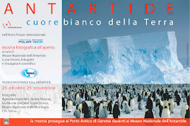
This book of photographs (dimensions: 28 cm x 32 cm - 224 pages ) is entirely focused on the ANTARCTIC and it is dedicated to the general public.
It is divided into four main chapters:

1) The continent
2) History of exploration
3) Life in an extreme environment
4) A continent of peace, dedicated to science

These four chapters are illustrated with a selection of pictures taken by photographers (including myself) from many different countries. Being a photo editor as well as a photographer I also made the photo selection, choosing the most spectacular photos I could find (among the photographers:Yann Arthus-Bertrand, Frans Lanting, Norbert Wu, Ingo Arndt, George Steinmetz, Paul Nicklen, Colin Monteath, Tui de Roy and others). Many are double page spreads.

There are four main texts, plus ten interviews with scientists or technicians from different countries involved with the Antarctic and 32 pages of “Encyclopedia” at the end of the book (16 double pages).

The foreword was written by Jean-Louis Etienne, a well-known French medical doctor and polar explorer who crossed Antarctica in 1989-90 with five other people from different nations, to draw attention to the Antarctic Treaty which was to be renewed. Jean-Louis Etienne climbed the Erebus, reached the North Pole on skis and will soon fly over the Arctic Ocean in an airship to study the effects of the global warming on the pack ice.

The most important thing for me was that the photographers and those interviewed should belong to different countries, and not to a single nation, since the key word in Antarctica is "collaboration". All the major science projects are international. Richard E. Byrd, the American explorer, wrote: "I am hopeful that Antarctica in its symbolic robe of white will shine forth as a continent of peace as nations working together there in the cause of science set an example of international cooperation".

The book will be on the bookshelves on October 12th. It will be
published in French by Belin publishers, and in Italian by Giunti editore.

Note on the author:

Lucia S. Simion was raised and educated in Italy and France, so she feel she belongs to both countries. In her childhood she used to live in Neuilly-sur-Seine, at walking distance from the house of Commandant J. B. Charcot, explorer of the Antarctic and the Arctic. After getting a medical degree, Lucia became a science journalist and professional photographer . She has participated in seven expeditions to Antarctica (three to Dome C-Concordia) and will soon be deployed on the ice again, to cover the ANDRILL project. Her dream is to winterover Antarctica.


Website: http://www.luceantartica.com
____________________________________________________________________________________

ITALIANO:

Lucia Simion

ANTARTIDE, il Cuore bianco della Terra
Editore Giunti

Uscita 12 Ottobre 2007
244 pagine, 300 fotografie
Prezzo di copertina: 39 €

Testi di Lucia Simion, fotografie di AA vari inclusa L. Simion

Lontano, molto lontano all’estremità della Terra c’è un continente misterioso e affascinante quanto un pianeta remoto e splendente. E’ l’Antartide, la Terra australis incognita immaginata da Aristotele duemila anni prima della sua scoperta, cercata dagli esploratori del Settecento, quindi svelata da quelli del XIX e del XX secolo : l’Antartide, un continente dedicato alla Pace e alla Scienza, che appartiene all’umanità intera, gestito collegialmente dalle nazioni che aderiscono al Trattato antartico. Richard Byrd, il grande esploratore americano che contribui’ a svelare vaste contrade del continente grazie all’osservazione aerea, scrisse : « Spero che nella sua veste immacolata l’Antartide continui a brillare a lungo come un simbolo di pace e di collaborazione per le nazioni e i popoli del mondo intero ».

« Antartide, il cuore bianco della Terra » è illustrato dalle immagini di alcuni dei più noti fotografi internazionali : Yann Arthus-Bertrand, Frans Lanting, Norbert Wu, George Steinmetz, Paul Nicklen, Ingo Arndt, Tui de Roy ; senza dimenticare i fotografi delle spedizioni di Scott e di Shackleton : Herbert Ponting e Frank Hurley. La selezione è stata fatta dall'Autore (Lucia Simion è stata Photo editor di parecchie riviste, e ha lavorato un anno all'agenzia fotografica Sygma).
Una particolarità di quest’opera sono le interviste con ricercatori, tecnici, esploratori, e fotografi di diverse nazionalità, che hanno lavorato in Antartide : il continente ci è svelato tramite le loro esperienze, le loro ricerche, le loro impressioni. Il volume esce in coincidenza con il quarto Anno polare internazionale, che si concluderà il primo marzo 2009. La prefazione è di Jean-Louis Etienne, medico e esploratore polare francese, che nel 1989-90 ha attraversato 6.300 km di Antartide con un team internazionale di 5 colleghi, per attirare l’attenzione sul rinnovo del Trattato Antartico. (C) Lucia Simion 2007

Biografia dell'Autore:
Lucia Simion è divulgatore scientifico da 20 anni, giornalista scientifico iscritto all'albo dal 1994 e fotografo professionista. Da 10 anni frequenta il mondo delle Scienze polari e ha frequentato tutti i più importanti Congressi scientifici internazionali sull'Antartide; è stata accreditata anche a un ATCM, Antarctic Treaty Consultattive Meeting (Riunione consultativa annuale dei Paesi membri del Trattato Antartico). E' laureata in Medicina con Lode all'Università Statale di Milano.
Lucia ha trascorso l'infanzia in Francia a Neuilly-sur-Seine, accanto a Parigi: abitava a due passi dalla casa del Comandante JB Charcot, medico e esploratore dell'Antartide e dell'Artico; Lucia era allieva del "Groupe scolaire Charcot". Lucia ha al suo attivo 7 spedizioni in Antartide (di cui 3 a Dome C, dove ha seguito e documentato per tre campagne la costruzione della base Italo-Francese Concordia (finanziata al 50% dall'Italia e al 50% dalla Francia) e lo svolgimento del progetto europeo di perforazione in ghiaccio EPICA. Lucia Simion è l'unico divulgatore scientifico e fotografo ad avere questa esperienza. Nell'arco di 8 campagne, il team del progetto EPICA ha estratto 3.300 m di carote di ghiaccio dalla calotta di Dome C: questo ghiaccio, datato circa 800.000 anni è attualmente il più "vecchio" ghiaccio estratto in Antartide. Nel futuro, un team internazionale di glaciologi (IPICS) tenterà di perforare la calotta di Dome A, dove il ghiaccio sarebbe datato 1 milione di anni. Lucia Simion è l'unico Italiano ad aver partecipato al corso post-doc "Graduate Certificate in Antarctic Studies" (GCAS) all'Università di Canterbury, Christchurch, Nuova Zelanda (2005); nell'ambito di questo corso ha trascorso 15 giorni in un campo remoto sulla piattaforma di Ross, preso l'Isola di Ross. Lucia Simion partirà a McMurdo nel Novembre 2007 per seguire e documentare il Progetto ANDRILL, SMS, a cui partecipa anche l'Italia (con gli USA, la Nuova Zelanda e la Germania). Nel Novembre 2008 il Servizio Filatelico delle Terre australi e antartiche francesi (TAAF) metterà in vendita un "Carnet de Voyage" Filatelico, contenente 14 fotografie e 14 francobolli realizzati con fotografie che Lucia Simion ha scattato a Crozet, Kerguelen, Saint-Paul e Amsterdam (isole subantartiche francesi). Lucia Simion ha visitato anche numerose altre isole subantartiche fra cui South Georgia, Macquarie, Campbell, Auckland islands e le Shetland del Sud.

In occasione del Festival della Scienza 2007 (e del Quarto Anno polare internazionale), Lucia Simion ha collaborato con il Museo Nazionale dell'Antartide di Genova alla realizzazione della mostra fotografica all'aperto: "Antartide, Cuore bianco della Terra". Le foto di Lucia Simion sono state esposte a Parigi (Centro Italiano di Cultura), a Océanopolis (Brest), alla sede dell'IPEV (Istituto polare francese), al MNA di Genova, a Brest in occasione della riunione 2003 del COMNAP, alla sede centrale del CNRS a Parigi, alla Cité des Sciences de la Villette (Parigi) e altrove.


NOTA: Questo testo puo' essere utilizzato esclusivamente per citare il volume in questione, di cui l'Autore è Lucia Simion. Per ogni altro scopo, contattare l'Autore o
l'Editore Giunti. Ogni abuso è illecito.


POLAR BOOKS COLLECTION: THE ARCTIC


Vanishing World
The Endangered Arctic


Photographs by Mireille de la Lez
Text by Fredrik Granath

“Vanishing World” is an unprecedented visual record of life in the Arctic. Five years in the making, this book is both a celebration of the wildlife that inhabits this harsh and unforgiving climate and a cautionary tale of global warming. Rising temperatures have put areas such as the Artic at risk and the livelihoods of the animals that live there are increasingly threatened.

Set against a dramatic landscape of ice floes and ragged mountains, readers will see the polar bears, foxes, seals, walruses, and reindeers who now struggle to live in this vulnerable climate. Images of a polar bear mother as she takes her newborns out for their first hunt, a seal pup only hours old, the spectacle of the polar night, and the majesty of the glaciers and pack ice are a reminder of what is at risk.

Mireille de la Lez’s stunning photographs are accompanied by text that explains the precarious nature of life in this dramatic climate. No one who sees the images of this vanishing world will be unmoved.

“Vanishing World” is published in English, French, German and Italian in October 2007:

English: “Vanishing World – The Endangered Arctic”
(Publisher Abrams, New York)

French: “Un Monde Fragile”
(Publisher: Éditions de La Martinière, Paris)

German: “Leben im Eis – Arktis in Gefahr”
(Publisher: Knesebeck Verlag, Munich)

Italian: “Polo Nord – Un Mondo Che Scompare”
(Publisher: Mondadori, Milan)

About the Authors

Nature photographer Mireille de la Lez and cowriter Fredrik Granath have spent years working in the high Arctic and specialize in photography and films of the polar regions. They live in Stockholm, Sweden.

For more information, visit:

www.novaphotomedia.com
www.vanishingworld.net

EMMENEZ-MOI AU BOUT DE LA TERRE


"Emmènez-moi au bout de la Terre, emmènez-moi au pays des merveilles", chantait Charles Aznavour.....(Les bateaux) Ils viennent du bout du monde, apportant avec eux des idées vagabondes, aux reflets de ciels bleus.....
Le Marion Dufresne, ce magnifique navire océanographique de 120 mètres de long, dont le port d'attache est La Réunion, vous emmènera sans doute "au bout de la Terre"
. Plus précisement dans les Terres australes et antarctiques françaises, les TAAF, une communauté territoriale crée en 1955, administrées par un Préfet-Administrateur Superieur basé à La Réunion. Depuis le mois de Mars 2007 le Préfet des TAAF est Monsieur Eric Pilloton.
Cinq sont les Districts qui forment les TAAF, mais trois seulement sont visitables à bord du Marion Dufresne (appelé également "Marduf" en jargon local): l'archypel de Crozet, les îles Kerguelen, Saint-Paul et Amsterdam. Iles perdues au fond de l'Océan Indien, entre l'Afrique, le Madagascar et l'Australie. Elles sont connues comme "les îles aux 25 millions d'oiseaux": albatros, manchots royaux, gorfous sauteurs, manchots papous, pétrels géants....En Octobre 2006, Dominique de Villepin (alors premier ministre) avait annoncé la création de la "Réserve naturelle des TAAF". Avec ses 700.000 hectares, il s'agit de la plus grande réserve naturelle de France, à 13.000 Km de la métropole.....
Le quatrième district des TAAF se trouve en Antarctique, il s'agit de la terre Adélie, mais il n'est pas ouvert au tourisme - du moins pas à bord du Marion Dufresne ou de l'Astrolabe, le navire ravitailleur de la base permanente Française Dumont d'Urville. Des TO Americains ou Australiens y font escale de temps à autre. Un cinquième distric a été ajouté en Février 2007, celui des Iles Eparses: Tromelin, Europa, Bassas da India, Glorieuses et Juan de Nova (Océan Indien).
Le tourisme dans les TAAF a commencé en 1994. Le "Marduf" effectue quatre rotations par an, des allées-retour depuis La Réunion et les trois districts insulaires (9.000 Km de voyage), en 28 jours. A chaque rotation, un petit groupe de touristes est accueillis à bord (entre 8 et 15), parfaitement intégrés parmi les scientifiques, les techniciens et tous les membres de l'equipage. Une expérience rare et - selon les témoignages recueillis - très marquante. "Sur les autres navires les conférenciers sont là pour faire un métier, sur le Marion tout est plus vrai, plus autenthique, plus convivial" (témoignage d'un passager). Les places sur le Marion étant limitées et très recherchées, il faut s'inscrire un an à l'avance.

Depuis leur création en 1955, les TAAF ont un propre Service philatélique indépendant, qui a émis juqu'à présent quelques 490 timbres TAAF et 4 Carnets de Voyage Philatéliques. Avant la fin de l'année, un cinquième Carnet de Voyage philatélique sera émis.


Pour informations (et pour obtenir la brochure en PDF), écrire au TAAF, à M.lle Stéphanie Payet, qui s'occupe du Tourisme:

stephanie.payet@taaf.fr

SITE WEB: http://www.taaf.fr

BLOG du Chef de District à Kerguelen,
YANN LIBESSART - voir aussi dans la colonne des LIENS:
http://kerguelen.blogs.liberation.fr/libessart/

Crédit photo: photo satellitaire de Kerguelen, NASA. Remarquer la calotte glaciaire du Mont Cook (500 Km2) et le Mont Ross, le plus haut sommet des TAAF (1800 m).

A GREAT GUIDE TO LEARN ANTARCTIC GEOSCIENCE


The ANDRILL-PROJECT ICEBERG Guide is now online and you can download it from the Andrill website (see the link below). The booklet -47 pages, beautifully illustrated with photos and cartoons, and a great layout- contains background information on the ANDRILL Project, discussion starters and hands-on activities for the students as well as the general public interested in learning Antarctic geoscience. Request the DVD with the Guide, plus 14 video journals produced by Megan Berg on the Ice during the 2006-2007 summer campaign. See the link below.

Instancabili nella loro attività didattica, i membri del Quartier Generale del Progetto ANDRILL (di stanza all'Università del Nebraska a Lincoln, Nebraska, USA), hanno messo online una splendida Guida "ANDRILL-PROGETTO ICEBERG", destinato agli insegnanti, ai divulgatori scientifici e a tutti coloro interessati ad approfondire le loro conoscenze sul tema delle Scienze Geologiche dell'ANTARTIDE, e sul Progetto ANDRILL in particolare. La guida è scaricabile online (vedere qui sotto il link), oppure si puo' richiedere una copia del DVD (che contiene anche 14 mini-video-giornali realizzati da Megan Berg in Antartide durante la campagna 2006-2007) cliccando sul secondo link indicato qui sotto, oppure facendo copia-incolla sul vostro motore di ricerca. Come tutto il materiale didattico prodotto da ANDRILL (USA), la grafica è accuratissima e molto, molto gradevole; le fotografie e le illustrazioni sono scelte in modo perfetto, i testi sono chiari e comprensibili da tutti. Lavoro eccellente.
La consulenza scientifica è di Judy Diamond, David Harwood, Richard Levy e Frank Rack (quest'ultimo è il direttore del Progetto ANDRILL). La guida è stata realizzata con il contributo di Megan Berg, insieme a LuAnn Dahlman e Julian Thomson, due insegnati che nella stagione 2006-2007 hanno partecipato al Programma ARISE per DIVULGATORI SCIENTIFICI. Bisogna veramente dire che i soldi investiti dalla NSF per sostenere la componente didattica (Education & Outreach) del Progetto ANDRILL sono stati magnificamente bene impiegati. Come usano dire i Francesi: "Châpeau!". Bravi.

REQUEST HARD COPY here: http://andrill.org/iceberg/partner/additional.php

DOWNLOAD THE ANDRILL-PI GUIDE HERE: http://www.andrill.org/iceberg/index.php

PHOTO-CREDIT: the "Andrill-PI-Guide" cover

LEOPARDS STRANDED ON A SYDNEY BEACH

FROM: The Sydney Morning Herald

PHOTO: by Oceanwide Expeditions (see the website below)

Text by: Richard Macey (SMH)

September 12, 2007

TARONGA ZOO marine specialists are fighting to save the life of the second Antarctic leopard seal to be washed up on a Sydney beach in a week.

Found stranded yesterday morning at Clontarf, the gravely ill female had been badly mauled by a cookie-cutter shark. The zoo is already nursing a male leopard seal that was found on Tuesday last week on a beach at Wattamolla in the Royal National Park. It had also been attacked by a cookie-cutter shark.

Leopard seals were very rare in Sydney's waters, said Geoff Ross, a wildlife management officer with the National Parks and Wildlife Service. "We might see one every two or three years," he said, adding that finding two in a week was extraordinary. "They are Antarctic ice dwellers which seldom wander further north than Macquarie Island."

Mr Ross speculated the seals might have been washed towards Sydney by the Southern Ocean storms that helped drive Sydney's unusually heavy winter rain.

"But there is a not a lot of food for them to eat in the deep ocean," he said, noting they normally dined on sea birds, including penguins, squid and fish that they would haul out of the water and onto the Antarctic ice.

As a result of being so far from home, both seals were malnourished, exhausted and near death when found. The one rescued last week weighed just 90 kilograms, about 50 kilograms lighter than normal for its age.

Besides the leopard seals, five sub-Antarctic fur seals have also been found washed up on the NSW coast this year, adding to the puzzle.

Australian scientists reported last month that they had used satellites to track southern elephant seals swimming up to 2000 kilometres through Antarctic waters to find a meal, raising suggestions something has disrupted their normal Southern Ocean food supply, and forced them to hunt further afield.

Mr Ross said one possibility was that climate change had reduced the Antarctic food chain. "It's still a bit of a mystery," he said. "We can hypothesise about why the seals are here, but we really don't have good solid answers."

He estimated that 95 per cent of Antarctic seals swept onto NSW beaches died. Under an international agreement, those that are rescued and survive cannot be returned to the wild because there is a risk they might have picked up lethal viruses while exposed to humans and other land animals.

Mr Ross warned anyone finding stranded leopard and fur seals to keep clear. "They have a massive set of jaws, with teeth like serrated knives."

Taronga's spokesman, Mark Williams, said that while the female leopard seal was very ill the male found last week was improving and eating fish by itself.

FROM: THE SYDNEY MORNING HERALD
http://www.smh.com.au/news/national/scientists-baffled-by-arrival-of-rare-seals/2007/09/11/1189276719712.html

PHOTO CREDIT: OCEANWIDE EXPEDITIONS
WEBSITE: http://www.oceanwide-expeditions.com/

Avventure antartiche durante la Guerra Fredda


The Ninth Circle,
A Memoir of Life and Death in Antarctica, 1960-62.

University of New Mexico Press, 2005.
Autore: John Behrendt

Ma era davvero un inferno dantesco, l'Antartide degli anni Sessanta? Una landa ghiacciata, sferzata da venti implacabili, soffiati da angeli e démoni? Per John Behrendt, autore di questo bel racconto di storia vissuta, le spedizioni in Antartide nel cuore della Guerra Fredda somigliavano all'ultimo girone dell'inferno
di Dante, il Nono cerchio. Ricercatori e tecnici che trascorrevano mesi e mesi laggiù in fondo al mondo, in quel paesaggio di ghiaccio che ricordava il lago Cocito erano più vicini a Shackleton, Scott e Amundsen che agli scientifici e i logistici di oggi. John Behrendt è geologo e ha ottenuto un PhD in geofisica all'Università del Wisconsin a Madison nel 1961. Sin da piccolino - leggendo i resoconti delle spedizioni di Richard Byrd su LIFE - Behrendt sognava di fare l'esploratore in Antartide. Membro dell'ISTAAR (Institute of Arctic and Alpine Research at the University of Colorado), John Behrendt ha lavorato 31 anni all'U.S. Geological Survey e ha partecipato a 13 spedizioni in Antartide. I suoi studi si sono focalizzati soprattutto sulla calotta dell'Antartide occidentale (WAIS), sui monti Transantartici e sui vulcani della terra di Marie Byrd. Durante l'AGY del 1957-58 partecipo' a una spedizione americana che installo' la più isolata delle sette basi che gli Stati Uniti avevano allora sul continente: la stazione Ellsworth sulla piattaforma di Filchner. Passo' oltre un anno in quel luogo perduto in capo al mondo. Behrendt ha raccontato le vicende di quel winterover, e l'esplorazione della piattaforma di Filchner-Ronne, del massiccio Dufek e dei monti Pensacola a bordo di snow-cats nel suo libro "Innocents on the Ice" (University Press of Colorado, P.O. Box 849, Niwot Colorado 80554, USA) pubblicato nel 1999. Nel nuovo libro "The Ninth Circle" racconta altre avventure antartiche vissute nel cuore della Guerra Fredda. Un giorno, sorvolando la calotta antartica occidentale in una zona di visibilità quasi nulla, il DC-3 su cui volava Behrend (intento a fare misurazioni con un radar altimetro, insieme ad altri che effettuavano rilevazioni magnetometriche)quasi si sfracello' sulla cima delle Crary Mountains, una catena di vulcani scoperti appena tre anni prima da una traversa condotta da Charles Bentley. Le carte di cui disponevano i piloti del DC-3, vecchie di 2 anni, non erano aggiornate e dunque le Crary Mountains non risultavano segnalate....! Volando in assenza completa di visibilità, il DC-3 era uscito miracolosamente indenne da quella situazione pericolosissima: aveva sfiorato le Crary mountains con un'ala...Anche le descrizioni delle basi (McMurdo, South Pole e Byrd) negli anni Sessanta - oramai quasi cinquant'anni fa - sono molto interessanti.
BIOGRAFIA: http://instaar.colorado.edu/people/bios/behrendt.html


ARTICOLO SU BEHRENDT pubblicato dall'Antarctic Sun: http://antarcticsun.usap.gov/2006-2007/sctn12-31-2006.cfm#

Uno strumento fantastico per apprendere divertendosi


Si chiama FLEXHIBIT, una parola composta da Flexible e Exhibit, ovvero "flessibile" e "mostra" ed è l'ultima trovata in termini di divulgazione scientifica del team di ANDRILL, Antarctic Drilling, uno dei più importanti progetti del quarto Anno polare internazionale. ANDRILL - il cui quartier generale si trova all'Università del Nebraska a Lincoln - è un progetto di perforazione nei sedimenti marini situati al disotto della piattaforma di Ross e del ghiaccio marino. I siti di perforazione si trovano nei pressi della stazione USA McMurdo e neozelandese Scott. Lo scopo del progetto ANDRILL è quello di recuperare delle carote di sedimenti al fine di comprendere come il clima dell'Antartide e le sue calotte di ghiaccio anno reagito e fluttuato in epoche remote, quando la temperatura era di 2-3 gradi centigradi più elevata di quella attuale, cosi' come la concentrazione di CO2. Questi dati serviranno per progettare modelli matematici che consentiranno di stabilire come l'Antartide e le sue calotte reagiranno a fronte dell'aumento delle temperature globali e all'aumento costante della CO2. Leggere il capitolo su ANDRILL in questo blog (pagine precedenti). Ma per tornare a "Flexible" e "exhibit", flessibile e mostra: che significa? E' più difficile da spiegare che da capire, e infatti vi consiglio di visitare il sito web di questo progetto, che è assolutamente fantastico. Gli autori - anzi, le autrici - sono due ragazze americane, LuAnn Dahlman (un'insegnante) e Megan Berg (che ha disegnato il sito web, i film che potrete vedere online e le fotografie). Flexhibit -una "mostra flessibile" - è un progetto multimediale sponsorizzato dalla National Science Foundation americana, nell'ambito di un progetto più vasto che si chiama "Antarctica's climate secrets" (I segreti del clima dell'Antartide) e che comprende anche un film realizzato per la catena televisiva americana NOVA TV, una serie di film e di podcast, e altro materiale multimediale. Mostra flessibile perché il materiale multimediale fornito (dedicato ai ragazzi di età compresa fra 10 e 15 anni) potrà adattarsi a a tutte le situazioni possibili: in classe, in campeggio, a casa, in una comunità, nel doposcuola. Flexhibit (che sarà disponibile a partire dal febbraio 2008) conterrà materiale multimediale rappresentato da posters su 5 diversi temi (sempre centrati sull'Antartide); esperimenti pratici realizzati con materiale poco costoso e facilmente reperibile (costo previsto del materiale: circa 100 Euro), brevi documentari online realizzati benissimo, interviste filmate (sempre disponibili online), fotografie, banners. Il tema di questa mostra flessibile è il progetto ANDRILLI: come si svolge, come lavora il team di ricercatori internazionali che vi partecipano (Italia compresa), qual è lo scopo. Il finanziamento della National Science Foundation per il progetto "Antarctica's climate secrets" è di 1.168.014 dollari US.

SITO WEB: http://www.andrill.org/flexhibit/index.html


Il sito web di Flexhibit (e parecchio materiale multimediale, soprattutto i "videogiornali" e altri filmati) è stato realizzato da una ragazza di appena 21 anni, molto dotata e molto determinata: Megan Berg. Il suo sito: http://www.meganbergdesigns.com

Banners: design realizzato dall'University of Nebraska State Museum, in collaborazione con ricercatori ANDRILL.


Genesi delle calotte antartiche: nuove ipotesi


Sepolte sotto una calotta di 2,5 milioni di chilometri cubi di ghiaccio, le rocce dell'Antartide occidentale si trovano per la maggiorparte al disotto del livello del mare. I ghiacciai e la calotta di questa porzione di Antartide hanno dunque "i piedi nell'acqua". Se la temperatura degli oceani aumenta, il rischio è che la calotta occidentale possa collassare, causando un aumento del livello marino di circa 6 metri. In collaborazione con la NSF, Christopher Sorlien e Bruce Luydendyk della University of California di Santa Barbara, hanno condotto una serie di analisi sismiche dei fondali marini dell'Antartide occidentale a bordo del rompighiaccio USA Nathaniel B. Palmer. Gli autori dello studio (pubblicato sulla rivista Geology nel maggio 2007) hanno stabilito che 25 milioni di anni fa l'Antartide occidentale era ben più alta sul livello del mare rispetto alla situazione attuale. Questo significherebbe che questa porzione del continente (West Antarctica per gli autori anglosassoni) puo' aver avuto un ruolo importante nella genesi delle calotte antartiche, molto più di quanto si pensasse precedentemente. Forse, altrettanto importante che l'Antartide orientale con i suoi picchi - come i misteriosi Monti Gamburtsev - su cui hanno iniziato a formarsi i primi "nuclei" della grande calotta orientale. Sui fondali dell'Antartide occidentale sono stati osservate tracce lasciate da vasti ghiacciai che un tempo si spingevano molto al largo, "dragando" i fondali, scavando valli e formando morene. Tutte queste prove sono state evidenziate grazie ad analisi sismiche, una specie di "ecografia" eseguita sui fondali marini, in grado di evidenziare strutture geologiche nascoste centinaia di metri sotto il fondale.


FOTOGRAFIE: Bruce Luydendyk/University of California Santa Barbara.

WEB: http://www.ia.ucsb.edu/pa/display.aspx?pkey=1628#description

A never-ending sad story


From the Sydney Morning Herald (July 25, 2007)

Japanese whalers have admitted almost all of the mature female minke whales they killed in Antarctic waters last season were pregnant. But that's good news, they insist, supporting their argument that the population is strong enough to allow a return to commercial whaling.

Japan's whaling research body, the Institute of Cetacean Research, today said 91.6 per cent - or 262 of the 286 mature female minkes taken during the last hunt - were pregnant.
"Almost all of the whales are becoming pregnant each year. This is good news. This is great. It shows that the Antarctic minke population is increasing rapidly," the ICR's Glenn Inwood said today.

"The consistent population must provide strong reassurance that the population will easily sustain a commercial quota." Inwood took issue with the way The Humane Society International (HSI) presented the issue yesterday. He said there had been no mention by the group that almost all mature female minkes were pregnant at the time the annual hunt goes ahead, typically from December until March.

In a statement yesterday, HSI said more than half of the minke whales captured by Japan in Antarctic waters last season, were pregnant. "It horrifies Australians to know that pregnant humpback whales breeding in the warm waters off Australia this winter will be targeted by the Japanese hunters in Antarctic waters this Christmas," HSI's Nicola Beynon said.

HSI was using figures from a review of Japanese reports from the most recent hunt, ahead of the resumption of a Federal Court case the group is taking against Japanese whaling company Kyodo Senpaku Kaisha Ltd. While HSI's assessment was not wrong, Inwood said it failed to provide an accurate context.
The group was being unnecessarily emotive, he said.

"Those figures from the Humane Society are extremely manipulative. They basically demonstrate the organisation's ignorance and lack of understanding," he said. "It is an extremely cynical move and I think what they are doing is using an ignorant media ... to manipulate the public of Australia and New Zealand."

Inwood said that of the 503 minkes taken last season, 104 were male and 349 were female.
Of the females, 63 were immature, 262 were mature and pregnant, and 24 were mature and not pregnant.

Japan carries out an annual whale hunt in Antarctica as part of its research program, aimed at providing data to resume commercial whaling. Whales hunted under the program ultimately end up on dinner tables, where whale meat is a traditional dish, leading to claims of whaling by stealth.


PHOTO CREDITS:

Minke whale in Antarctic waters: Steven Profaizer/National Science Foundation

Whaling: Kate Davison/The Sydney Morning Herald

WEBSITE:

http://www.smh.com.au/news/whale-watch/killing-pregnant-whales-is-good-news-whalers/2007/07/25/1185339064854.html

SIR EDMUND HILLARY: il Signore dei Ghiacci


Nel numero 31 uscito il edicola il 5 agosto, il settimanale Famiglia Cristiana della San Paolo Edizioni dedica un reportage di tre pagine a Sir Edmund Hillary, il conquistatore dell'Everest nel 1953 e il primo uomo a raggiungere il Polo sud geografico con mezzi motorizzati terrestri (dei trattori Ferguson), nel corso del terzo Anno polare internazionale del 1957-58. Sir Ed Hillary è anche il fondatore della base neozelandese Scott sull'isola di Ross, di cui si celebra il Cinquantesimo anniversario della fondazione quest'anno (2007). Il Primo marzo 2007 è iniziato il Quarto Anno polare Internazionale, dedicato allo studio dell'Artico e dell'Antartide.

On the August 5th issue, the weekly magazine Famiglia Cristiana, one of the leading newsmagazines in Italy (circulation: 800.000 copies/week) published an article on Sir Edmund Hillary, conquerer of the Everest and first man ever to drove a vehicle to the South Pole during the AGY-IPY 1957-58. Hillary was co-leader of the Commonwealth TransAntarctic Expedition (TAE) with Bunny Fuchs, who crossed Antarctica from the Weddell sea to the Ross sea in 99 days. Hillary drove from Ross Island up the Skelton glacier, through the Transantarctic Mountains, then across the polar plateau to the Pole, where he arrived on January 4th, 1958.

LIBRI-BOOKS:


Sir Edmund Hillary, No latitude for error, Hodder & Stoughton, 1961


Sir Vivian Fuchs-Sir Ed Hillary, The Crossing of Antarctica, Cassel, 1958